Weather and snow measurements
 Metek Micro Rain Radar
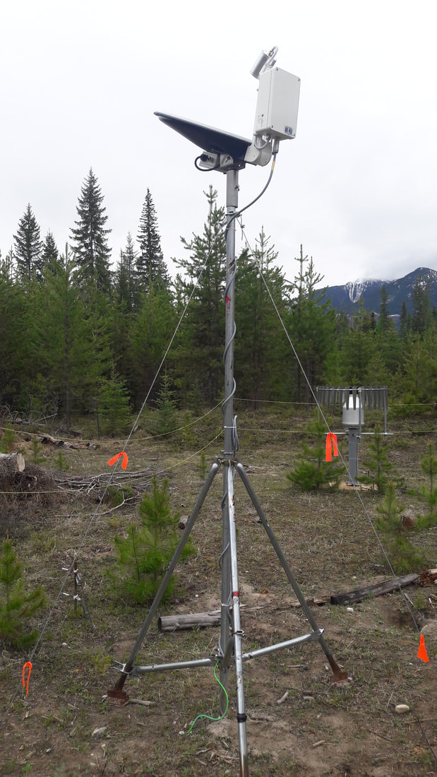
Micro Rain Radar (Metek MRR 2)
The Micro Rain Radar (MRR) is a vertically pointing microwave weather radar that provides scientists information about rain rate, liquid water content, and drop size distribution from the surface up to several hundred meters.
Applications include:
The Micro Rain Radar (MRR) is a vertically pointing microwave weather radar that provides scientists information about rain rate, liquid water content, and drop size distribution from the surface up to several hundred meters.
Applications include:
- Observation of the melting layer (bright band / freezing layer)
- Drop size distribution
- Now-casting of precipitation events
- Weather radar signal adjustment
- Hydrology / precipitation studies
- Cloud physics studies
- Rain measurements on ships and platforms
- Chemistry changes through precipitation transport
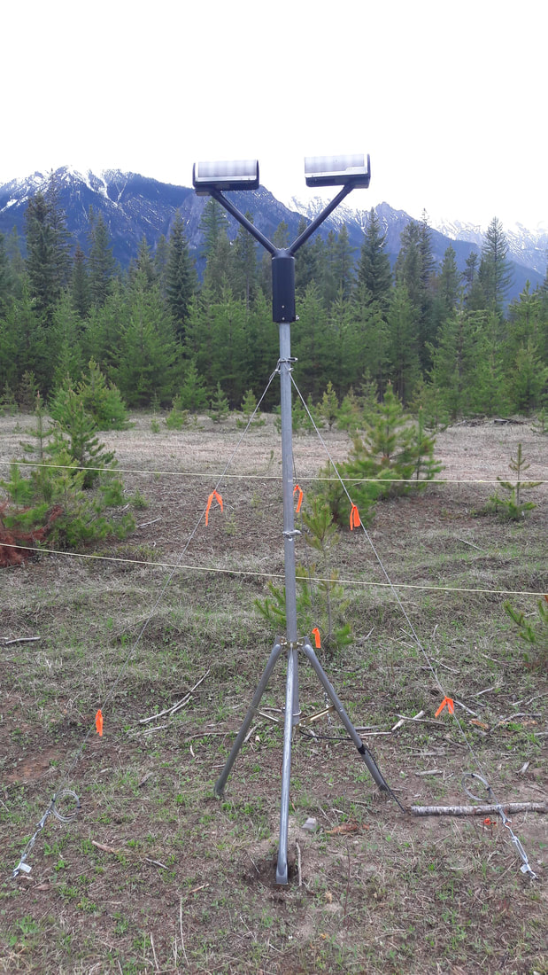 OTT Parsivel 2 laser disdrometer
Parsivel disdrometer (OTT Parsivel2)
The OTT Parsivel2 is a laser disdrometer that provides measurements of all precipitation types. The parsivel captures both the size and speed of falling particles, classifying them into one of 32 separate size and velocity classes. The raw data are used to calculate the type, amount, intensity, and kinetic energy of the precipitation, the visibility in the precipitation, and the equivalent radar reflectivity.
Examples of use:
- Precipitation measurement: complete precipitation measurement including particle size, volume, and intensity.
- Monitoring road conditions: precipitation amount and composition are combined with general visibility measurements to provide an accurate picture of road conditions.
- Early flood warning: when combined with water level sensors, the Parsivel2 is the central component in an early flood warning system.
- Erosion modelling: kinetic precipitation energy calculated by the Parsivel2, paired with other parameters like ground state or relief, provides a key input for erosion models.
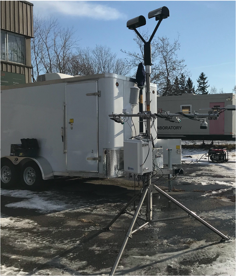 Meteorological instruments with the Mobile Urban Station (MUST)
The UQAM Mobile Urban Station (MUST)
The Mobile Urban Station (MUST) is mobile laboratory that provides a platform for in-situ studies of weather and atmospheric science. The truck and trailer combination of the MUST allows the field team to locate instruments where the weather might be the most interesting for a particular study. This could be along a rain/snow boundary, underneath a strong inversion, or in an area of intense precipitation.
Instruments include:
- Micro rain radar (MRR Pro)
- OTT Parsivel laser disdrometer
- Instruments for measuring near-surface meteorological variables: temperature, humidty, wind, net radation, soil temperature, precipitation amounts
- An eddy covariance system for calculating surface mass and energy fluxes
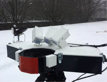 The Multi-Angle Snowflake Camera. PHOTO CREDIT: BRIAN COLLE
Multi-Angle Snowflake Camera (MASC)
The Multi-Angle Snowflake Camera (MASC) provides 10 to 40 µm resolution stereoscopic images of individual hydrometeors in freefall, while simultaneously measuring their fallspeed. The MASC is fully automated and uses a sensitive infrared trigger to capture images of a large variety of hydrometeors.
Applications include:
- Improving understanding of the relationship between the size of hydrometeors and their fallspeed
- Identifying hydrometeor types and relative quantity
- Estimating precipitation rates in conjunction with a scanning terrestrial LiDAR
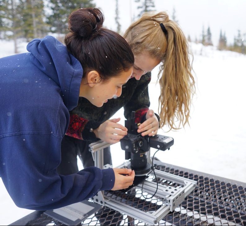 Students take microphotographs of snow crystals
Manual observations and microphotography
During the intensive field campaign portation of SAJESS, students and staff will perform manual observations of weather conditions and record important information about precipitation events that may be difficult to capture with instruments alone. When solid precipitations occurs (e.g. snow or hail), the field team members will capture particles and photograph them to record more information about the type of precipitation and the state of the atmosphere that the hydrometeor (a water or ice particle in the atmosphere) fell through on its way to the surface.
Observations include:
- Type and intensity of precipitation
- If snowing, the different types of snow crystals present
- If freezing rain occurs, the amount of ice accumulating on various structures
- Other interesting weather phenomena difficult to record using instruments, for example: the presense of virga (rain that does not reach the ground)
